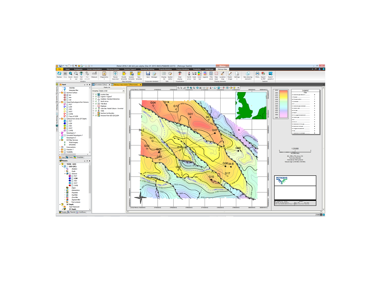
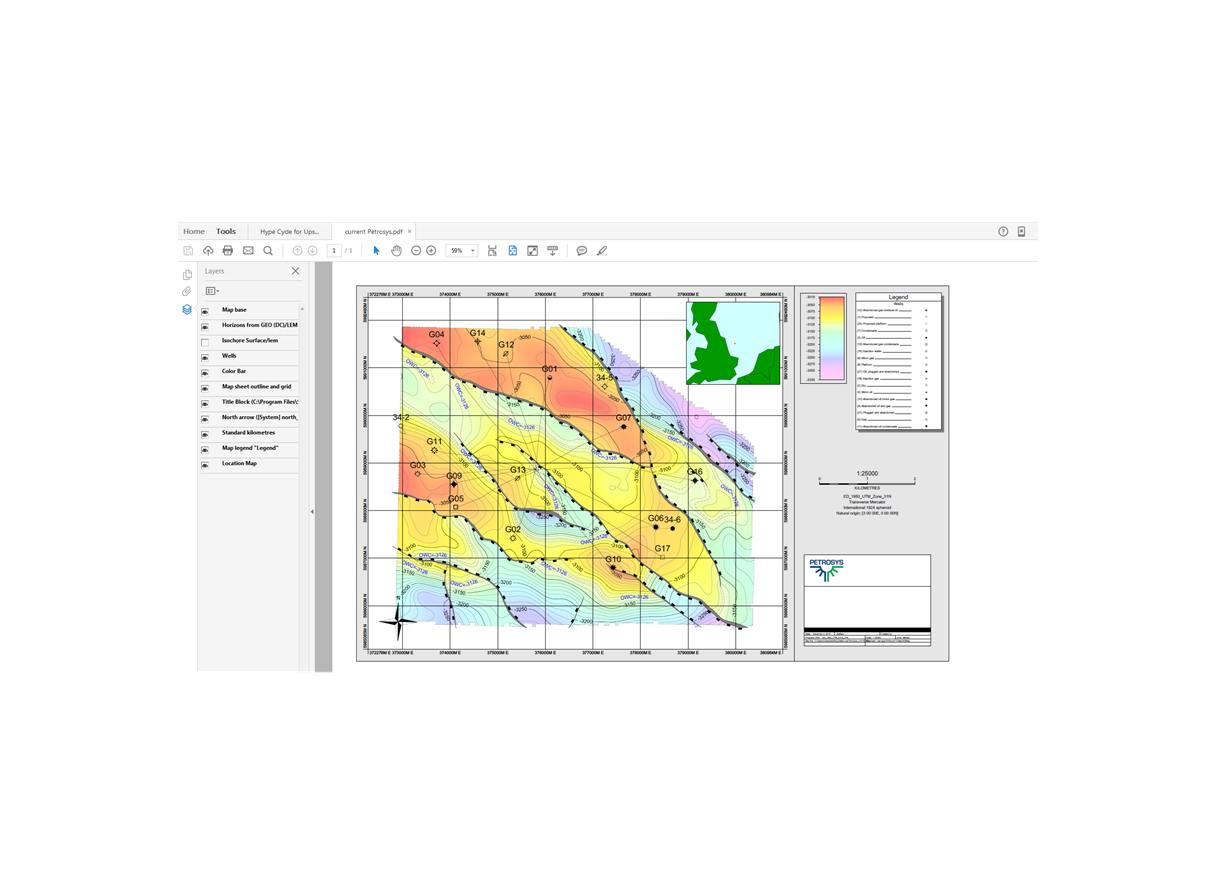
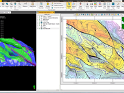
Petrel mapping module by Petrosys extends existing Petrel subsurface software mapping capabilities, enabling the editing and creation of high quality maps. The Petrosys mapping window in Petrel produces high quality mapping output for printing, PDFs, or images for reports, and re-projection of 2D surfaces, 3D grid horizons, and seismic interpretation in any coordinate reference system.
Features
- Flexible map legend, templates customized to meet organization standards
- Sophisticated overposting control Contour editing and clean-up
- Contouring up to faults together with fault direction indicators
- Fine control of fonts, color and line styles for all mapping elements
- Thematic mapping of culture data